BrazilDAM Dataset
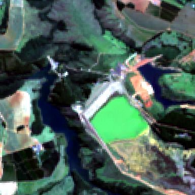
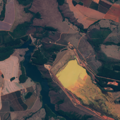
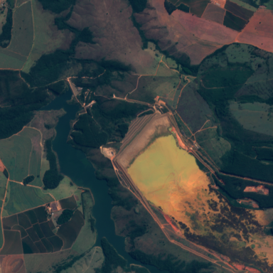
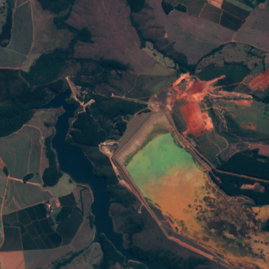
BrazilDAM is a multi sensor and multitemporal dataset that consists of multispectral images of ore tailings dams throughout Brazil. Landsat 8 and Sentinel 2 satellites that capture multispectral images over the years 2016, 2017, 2018 and 2019 were used. The dataset contains samples collected in different regions, which increases the diversity and representativeness of the characteristics of the dams.
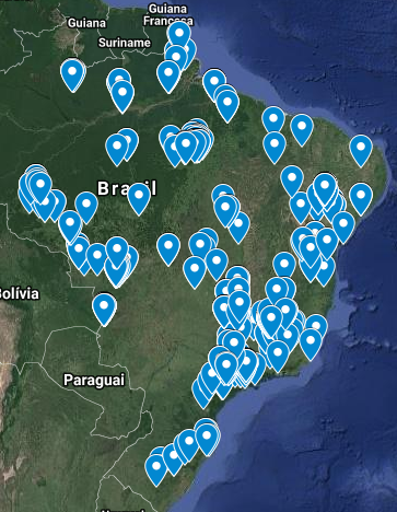
Coordinates data came from the Brazilian National Mining Agency that's made available on its website a georeferenced database describing all officially registered tailings dams in the country. The database contains some identification information about the dams and their owners and spatial coordinates of a point indicating each dam’s location. There is also some technical information like the main ore, height, volume, constructive method, risk category, potential damage associated with the dam.
2016
2017
2018
2019
LANDSAT

SENTINEL
")
Statistics
Results of methods and tools evaluated against the RCPD dataset:
| Satellite | Landsat 8 | Sentinel 2 | ||
|---|---|---|---|---|
| Year | Dam | Not Dam | Dam | Not Dam |
| 2016 | 761 | 1143 | 769 | 1156 |
| 2017 | 769 | 1155 | 769 | 1156 |
| 2018 | 769 | 1156 | 769 | 1156 |
| 2019 | 756 | 1130 | 769 | 1156 |
Citation
The dataset is described in the paper BrazilDAM: A Benchmark dataset for Tailings Dam Detection
If you mention the BrazilDAM dataset, please use the following reference:
@inproceedings{
  ferreira2020brazildam,
  title={BrazilDAM: A Benchmark dataset for Tailings Dam Detection},
  author={Ferreira, E., Brito, M., Alvim, M. S., Balaniuk, R., dos Santos, J.},
  booktitle={Latin American GRSS & ISPRS Remote Sensing Conference 2020, Santigo, Chile},
  year={2020},
  organization={IEEE}
}
|